
Rocca di Manerba hike
Easy hike in the south of Lake Garda

The Rocca di Manerba may well be the most striking rock formation on southwestern Lake Garda. The easy hike up and around the Rocca impresses with beautifully laid out paths, an enchanting landscape, rich flora and historical gems.
Route description Rocca di Manerba
The hike to the Rocca di Manerba begins in square S. Bernardo in the tranquil village of Montinelle on the southern shore of Lake Garda.
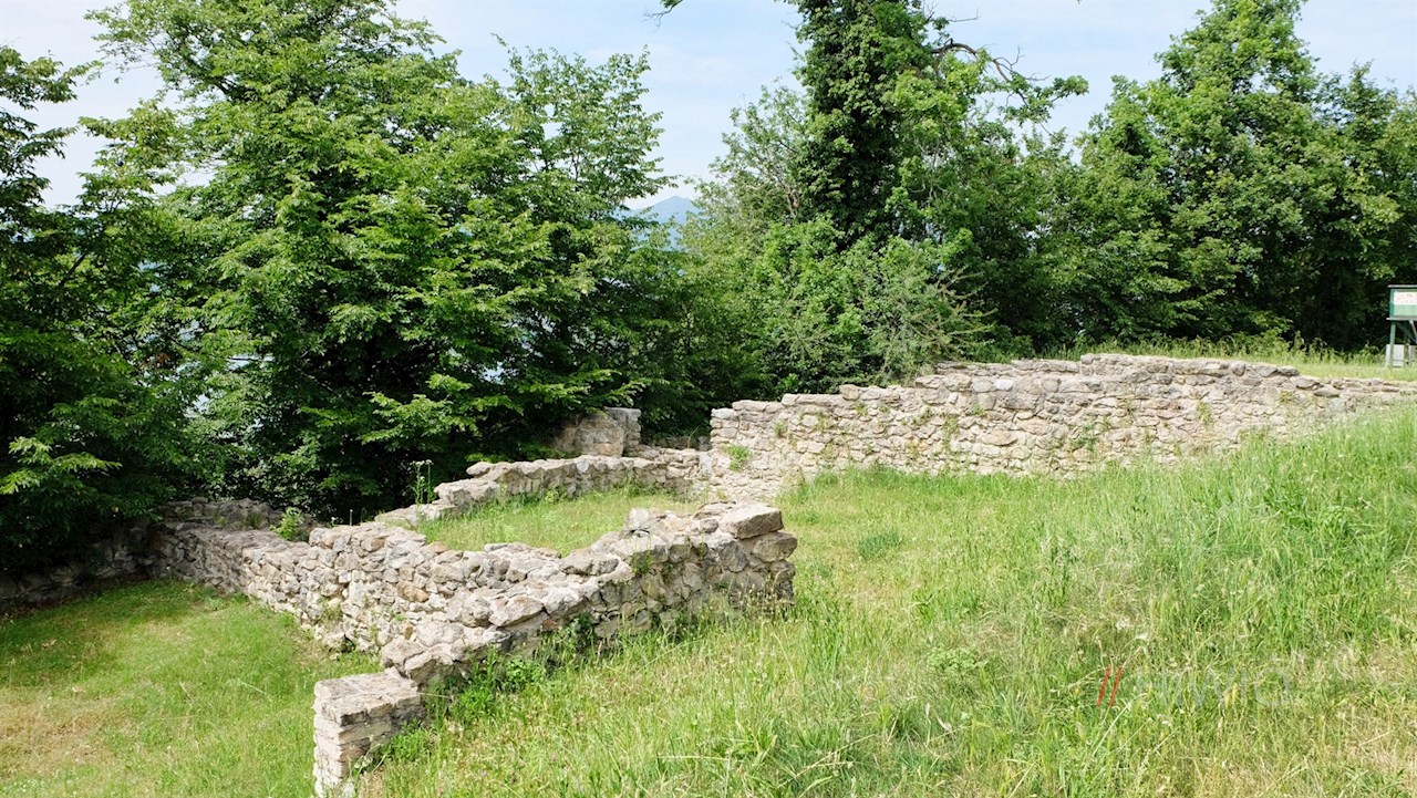
Following successively Via Leutelmonte and Via Roccette, you reach the gate of the fortified castle that gave its name to the rock. Since the medieval fortress was severely damaged by the Venetians in the 16th century, only its remains can be seen today.
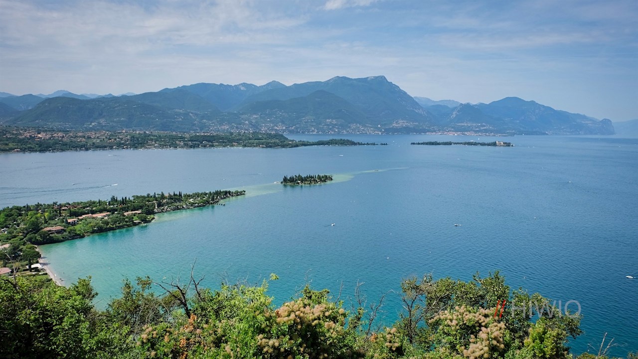
A little later you reach the heart of the complex, adorned with a graceful summit cross. At this highest point of the hike, dreamlike views of lower Lake Garda open up, with its picturesque places such as Bardolino, Lazise, the Rocca di Manerba, Punta San Vigilio or the cypress island of San Biagio.
Behind the suggestive summit cross, a rope-secured path covered with stones and rocks leads steeply down. A little later, the path branches off to the right and immediately plunges into a dense scrub forest.
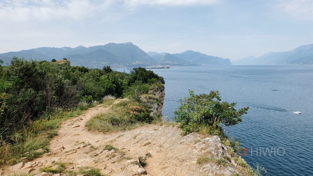
At the next fork, keep to the path and, after a short counter-ascension, walk in front of the picturesque backdrop of Lake Garda to the edge of the steep cliffs, which are a sought-after photo motif.
The path now passes close to the precipices and soon plunges again into a scrub forest.
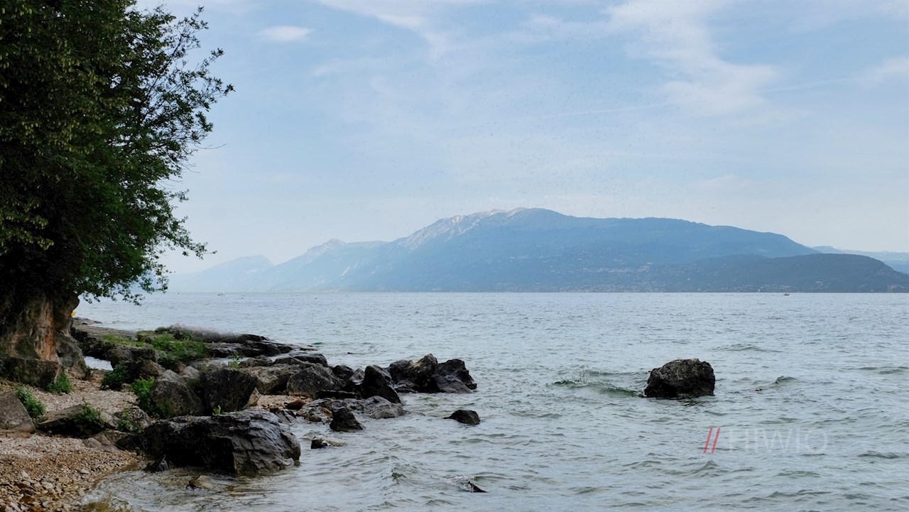
On the way, you will come across a sign that reads "Al lago spiaggia", which points the way to a picturesque stretch of beach. This little detour should not be missed.
Finally, a narrow path branches off to the idyllic church of San Giorgio, probably built in the 7th century and extensively renovated in the 16th century. Through the windows you can see the suggestive interior of the church, dedicated to St. George.
From the church, follow the paved road (via S. Giorgio and via Carducci) that leads back to Montinelle.
Along the way, numerous information panels provide interesting insights into the history, flora and fauna of the nature reserve.
What the name Rocca di Manerba means
By the way, the name Rocca di Manerba derives from the Roman goddess Minerva, goddess of wisdom, art and strategic warfare. At the time of the Romans, a temple is said to have been built to the goddess on the steeply sloping rock.
Interesting facts about the hike to Rocca di Manerba
This hike leads through the nature reserve "Riserva Naturale Orientata della Rocca, del Sasso e Parco Lacuale di Manerba del Garda", which covers an area of 1,160,000 m2 of land and 850,000 m2 of lake area. The nature reserve was created to protect its archaeological and landscape features.
Archaeological excavations have brought to light prehistoric, Roman and medieval findings that indicate the long settlement of this area. These include, for example, a terraced Roman villa or a Roman necropolis.
Infos Rocca di Manerba hike
- Duration:01:30 h
- Length:5.1 km
- Height gain:150 m
- Min. elevation:72 m
- Max. elevation:206 m
Pictures Rocca di Manerba hike


Height Profile
Weather

Current Values Near