
Hike from Riva del Garda to Monte Brione
Hiking from Riva del Garda to the fortresses on Monte Brione
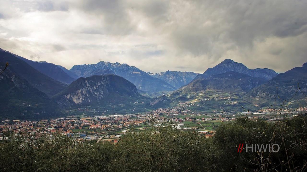
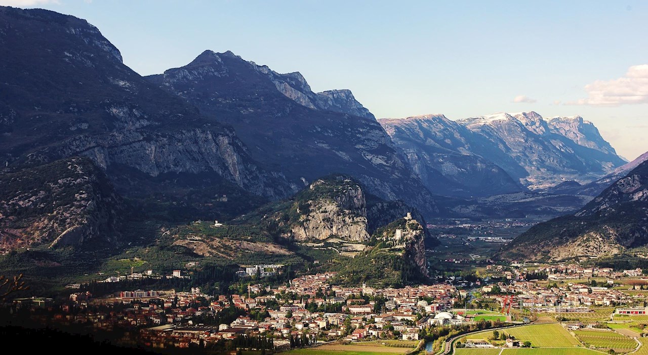
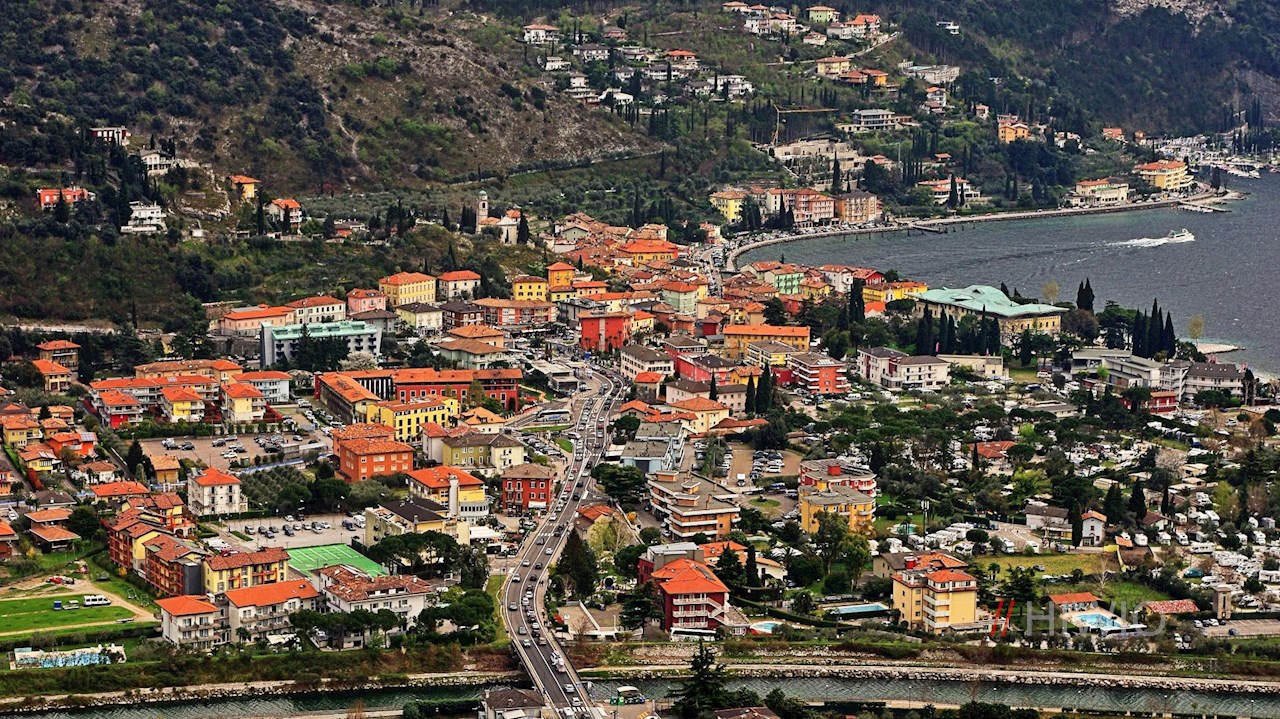
In order to protect its southern border from Italian encroachment, the kingdom of Austria-Hungary also had several fortresses built on lake Garda from the second half of the 19th century. Four of them can be found at and on Monte Brione. This hike on a section of the "Sentiero della pace", which stretches for about 500 km along the former border of the Danube Monarchy, leads past them. It also offers a rich vegetation and picturesque views of the northern lake Garda and its surroundings.

Route description Monte Brione
The starting point is the port of San Nicoló on the eastern outskirts of Riva del Garda, near which there is a spacious car park. After a detour to the first of the four fortifications, the "Forte San Nicoló" at the port, follow the path that branches off behind it to Monte Brione. This leads to a path with stairs, along which you quickly gain altitude.
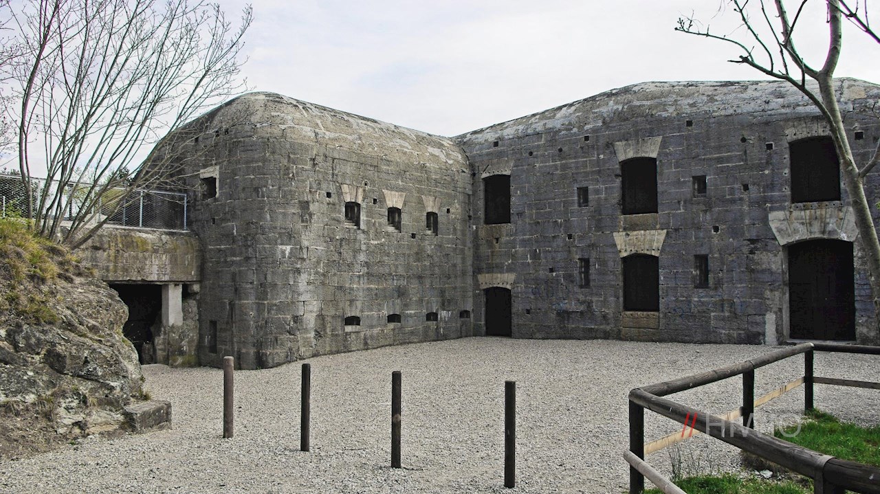
Soon you reach "Forte Garda", a well camouflaged monumental fortress in reinforced concrete, built at the beginning of the last century and one of the most modern military installations of its time. From it also leads(s) away a tunnel about 300 meters long, equipped with staircases and lookouts, in which today, however, there is danger of collapse.
Rich in picturesque views, the path then winds its way to the well-preserved central battery, the "Batteria di Mezzo". Perched on a hill, it was used to guard the area around Nago and the mouth of the Sarca river. In 1915, during the war, it was also equipped with a tunnel that led to observation posts on the vertical rocks of Monte Brione.
From this fortress it is possible to make a short detour to the transmission towers a little higher up or to continue immediately to the last of the four fortifications, the "Forte Sant' Alessandro" (North battery or Campedell). Partly overgrown and left to decay, it is the smallest and highest of the four batteries. Those stationed here were responsible for the surveillance of the area around Arco. They were also supposed to come to the rescue when optical signals were sent from the other forts. This relatively simple type of fortress, built on almost plane terrain, is found exclusively in the Trentino area.
For the way back from Monte Brione, the outward route is recommended. Alternatively, you can continue the hike along the path that branches off to the right of the fortress entrance, which also leads back to Riva del Garda.
Details about Monte Brione
Because of its plant diversity, the ridge of Monte Brione was designated a biotope in 1992 and thus placed under nature protection. About 500 different species are said to thrive in this relatively small area. Among them are wild orchids, some of which grow only here in the entire Trentino.
In 1859 the kingdom of Austria-Hungary had already lost Lombardy; in 1866 it also had to cede Veneto and thus the eastern shore of lake Garda to Italy. The border with the new kingdom of Italy, which had been founded in 1861, now ran between Torbole and Malcesine. If the Danube Monarchy had already fortified the "old new" border with installations, further fortifications were to be built as a result of the new border demarcation. The three bastions on Monte Brione date back to this period.
Hiking time Monte Brione
Hiking Monte Brione: 2.5h
Infos Hike from Riva del Garda to Monte Brione
- Duration:02:00 h
- Length:5.3 km
- Height gain:375 m
- Min. elevation:65 m
- Max. elevation:363 m
Pictures Hike from Riva del Garda to Monte Brione


Height Profile
Weather

Current Values Near