
Monte Piana hike Misurina
Hiking to the open air museum Monte Piana of Misurina
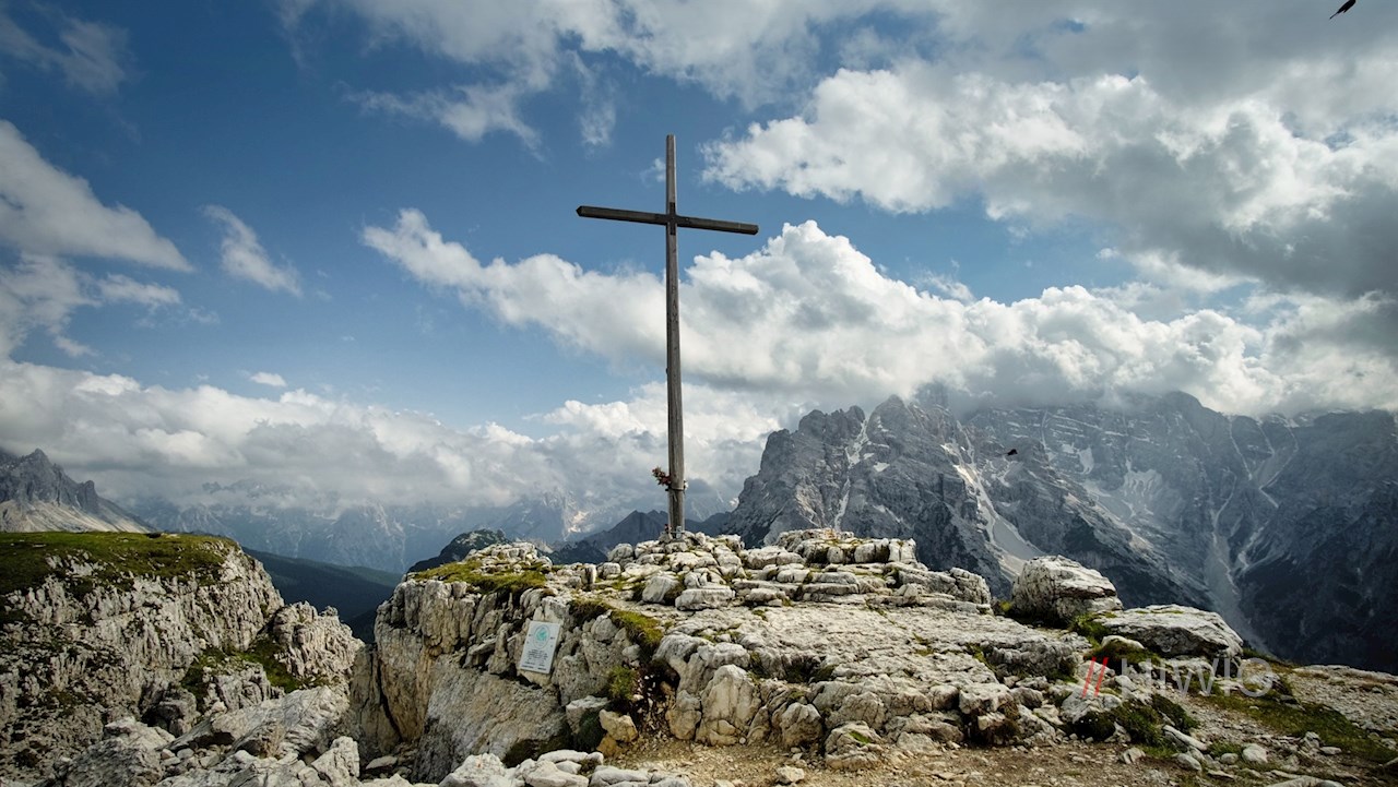
Monte Piana and its northeastern peak monte Piano, steeped in history, were the scene of a loss-filled war of position during the first world war. Even today, the monte Piana open-air museum is a reminder of this dark chapter in history. At the same time, however, monte Piana is one of the most beautiful panoramic mountains of the eastern dolomites, which, in addition to the rope-secured ascents, can also be hiked on an easy path passing by lake Antorno.
Route description monte Piana lake Antorno
The hike to monte Piana starts at the car park which is located between the Misurina lake and the Antorno lake (Fonda Savio mountain hut car park).
At the car park, first follow the path that branches off to the left and winds its way up along the road to the idyllic lake Antorno. On its northern shore, hiking trail no. 122 branches off in the direction of monte Piana.
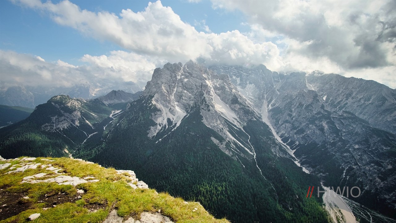
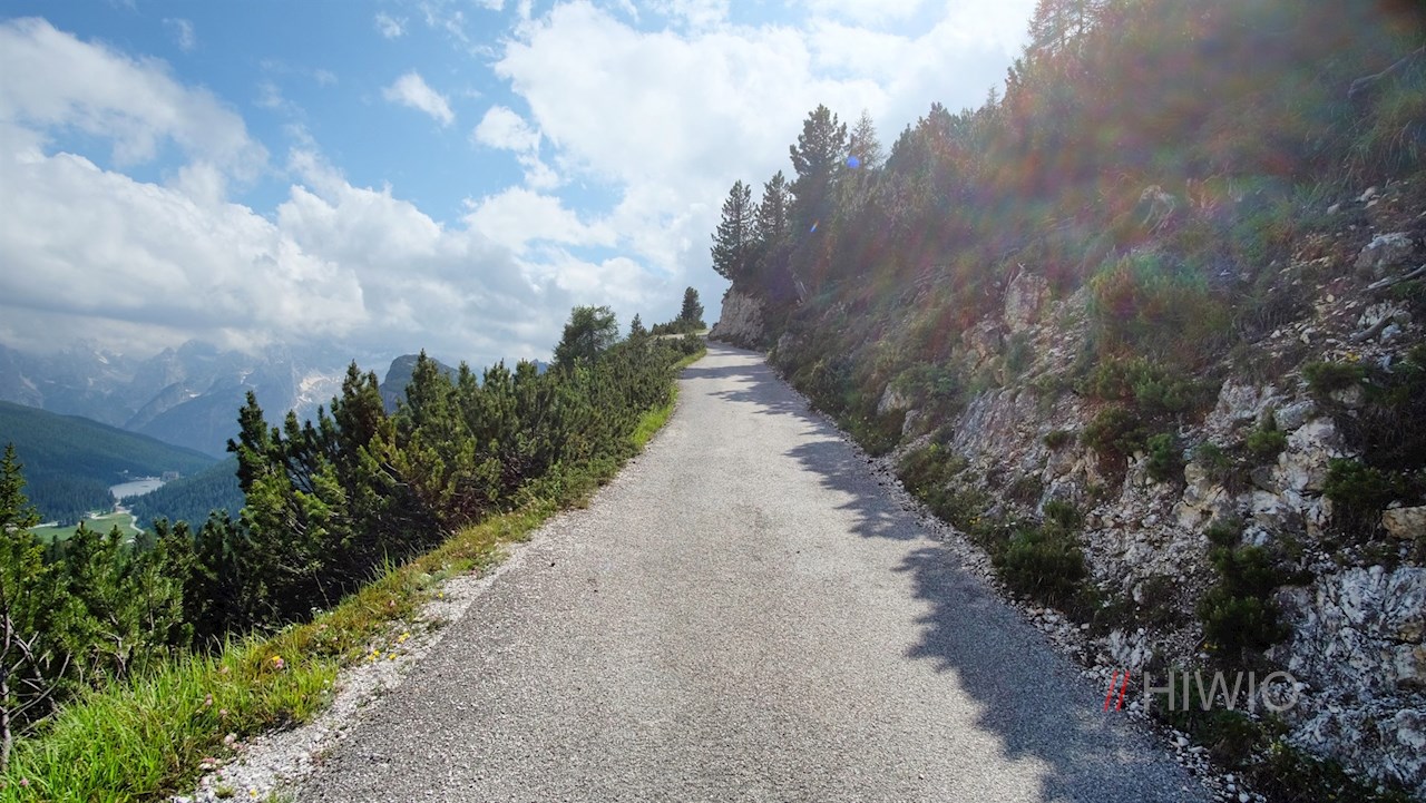
It climbs pleasantly through the woods and finally turns into an asphalted old military road. It winds its way up in numerous switchbacks to the inviting monte Piana moutain hut A. Bosi, opening up breathtakingly beautiful views of the Tre Cime di Lavaredo and the Cadini di Misurina.
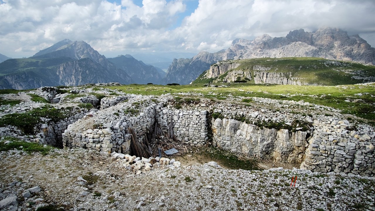
At the hospitable Bosi mountain hut, the historic circular trail over monte Piana, also signposted with no. 122, branches off to the left. Along the path, bomb craters, troop bases, trenches and trenches remind us of the war of position between Austria-Hungary and Italy, which lasted from 1915 to 1917 and in which about 14,000 mountain soldiers lost their lives. Most of them found their last resting place in the soldier cemetery in the Valle di Landro valley near Dobbiaco.
At the same time, however, the circular route also opens up unforgettably beautiful views of the surrounding dolomite peaks, of which the Three Peaks, the monte Paterno, the Cadini di Misurina, the Sorapis, the Cristallo and the Croda Rossa in particular catch the eye. At our feet, meanwhile, shimmer the Misurina lake and the Landro lake.
The way back from monte Piana is the same as the way there.
The first world war on Monte Piana
On June 7, 1915, monte Piana was taken by the Austrian soldiers and fortified despite the resistance of the Italians. A little later the italian troops managed to capture its southern side. Since the border between Italy and the Habsburg monarchy of Austria-Hungary ran through the middle of monte Piana, both sides wanted to hold this strategically important mountain. What followed was a bloody war of position that lasted two years and ultimately failed to bring about a decisive turning point.
In the 1980s, the old tunnels, troop bases, barrel trenches, trenches and other historically significant finds were uncovered and a historical circular trail was created: The open-air museum monte Piana was born. Since then, monte Piana is not only a picturesque panoramic mountain, but also a historical memorial, reminder and memorial.
Infos Monte Piana hike Misurina
- Duration:04:15 h
- Length:12.2 km
- Height gain:550 m
- Min. elevation:1758 m
- Max. elevation:2322 m
Pictures Monte Piana hike Misurina


Height Profile
Weather

Current Values Near