
Corno Bianco hike
Hike from Passo Oclini pass to the Corno Bianco and to the Malga Gurndin alpine pasture
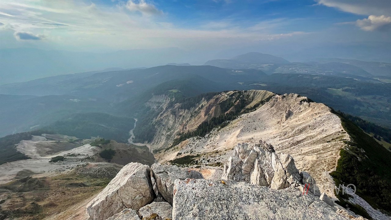
On the Corno Bianco summit, a breathtakingly beautiful view of the towering Dolomites, the nearby Corno Nero and the deep Bletterbach Gorge, which tells of 40 million years of geological history, opens up.
Route description Corno Bianco
The hike to the Corno Bianco (white horn), also known as the Corno d 'Ega or Corno Bianco of Aldino, begins on the almost 2,000 m high Passo Oclini pass, which is cut between the Val d'Ega valley and the Val di Fiemme valley.
At the parking lot, the mountain trail marked with an H branches off in the direction of the Corno Bianco. It leads in a pleasant ascent through the meadows at the foot of the Corno Bianco, which it approaches visibly.
At the next fork, you can take the shortest way up to the Corno Bianco. However, we keep to the more scenic high trail that branches off to the right and winds its way through the pine-covered meadows in front of the picturesque backdrop of the Corno Nero, the Pala di Santa peak (Zanggen), the iconic Catinaccio (Rosengarten) and the impressive Sciliar (Schlern).
At the next fork in the path, an impressive view opens up into the Bletterbach gorge, which provides unique insights into 40 million years of the earth's history and the structure of the Dolomites.
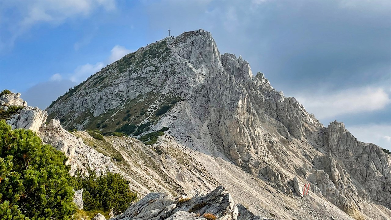
Here the narrow path no. 5 branches off to the summit of the Corno Bianco, now about 30 minutes away. It first leads over a steeply sloping ridge, partly covered with gravel and stones, partly covered with grass, opening up ever new views of the lower lying Bletterbach gorge.
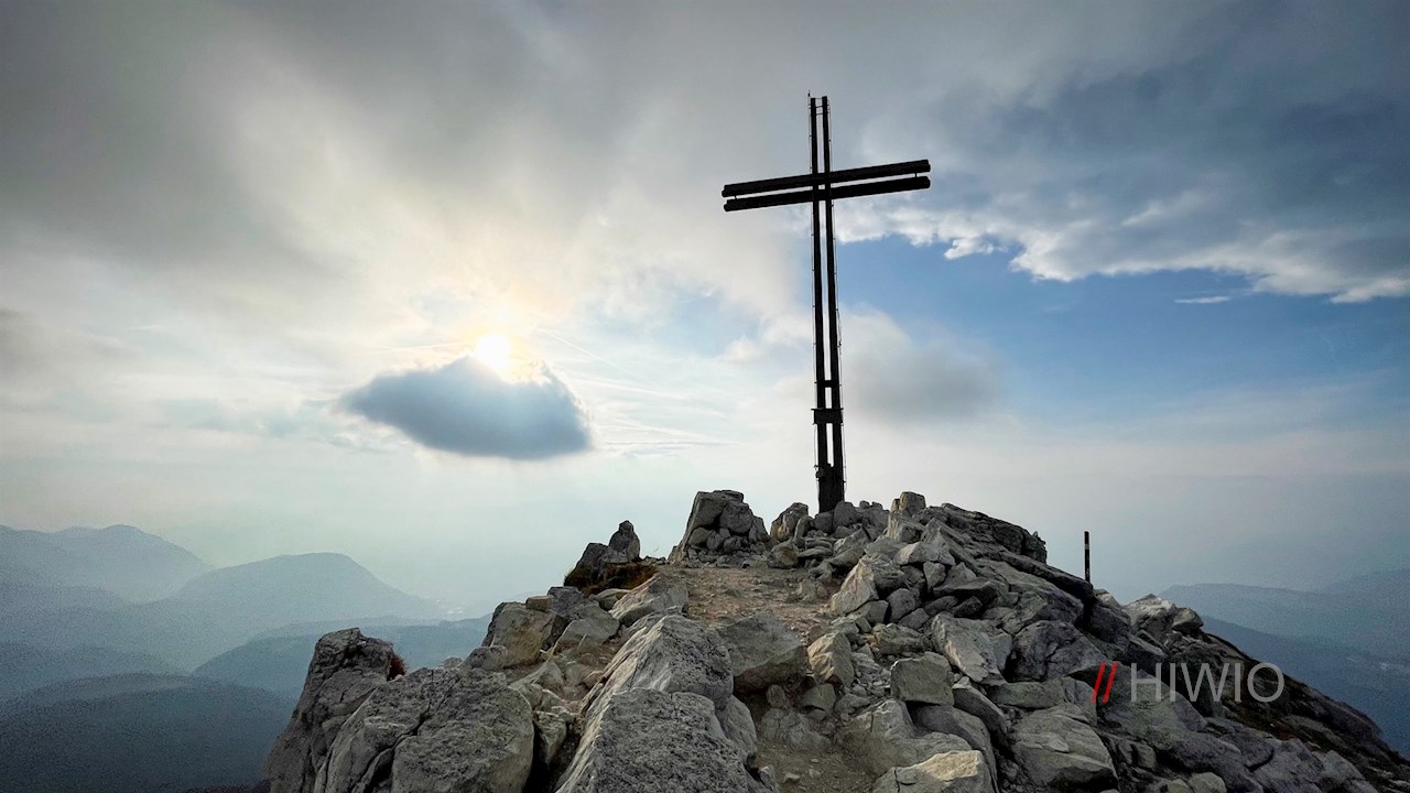
Finally, it climbs over rocky passages secured with steel ropes to the summit of the Corno Bianco. Next to the elegant summit cross, a view unfolds that is unparalleled: The view sweeps from the neighboring Corno Nero (black horn) over the surrounding Dolomites to the lower lying Val d'Adige valley.

Way back Corno Bianco
A little below the summit, the hiking path no. 12 branches off in the direction of Radein. It descends over initially rocky, later grassy and pine-covered slopes to a beautiful panoramic point, where the most impressive view of the Bletterbach gorge opens up.
Here the mountai trail branches off to the now nearby Malga Gurndin mountain hut. In the idyllically situated alpine cabin the guests are spoiled with temptingly fragrant Tyrol delicacies.
From the Malga Gurndin pasture, the hiking trail leads almost level back to the starting point on the Passo Oclini pass.
Note hike Corno Bianco
Although the last ascent to the Corno Bianco peak is technically quite easy to master for hikers used to climb in the mountains, it requires surefootedness and a head for heights in view of the steep slopes.
Infos Corno Bianco hike
- Duration:02:45 h
- Length:7.3 km
- Height gain:425 m
- Min. elevation:1951 m
- Max. elevation:2309 m
Pictures Corno Bianco hike


Height Profile
Weather

Current Values Near